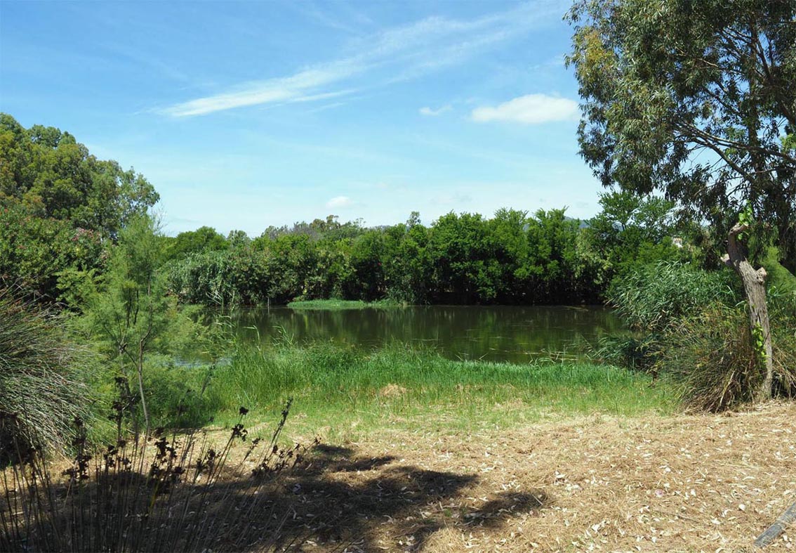
ITG27SAR2362 - Laghetto del Timiama
Wetland data
Basic information
| Wetland location: |
Marine/Coastal |
| Wetland type: |
Natural |
| Wetland area: |
0.3 Ha |
| Hydrological interaction: |
Yes |
| Water salinity: |
Brackish (5.0-18.0 g/l) |
| Hydroperiod: |
Unknown |
Geographic information
| Region: |
Sardinia |
| Province: |
Cagliari |
| Island: |
Sardinia |
| Municipality: |
Villasimius |
| Longitude: |
9.514515 East |
| Latitude: |
39.121288 North |
Wetland condition
| Wetland status (MEDWET): |
5 - Original habitats/landform totally changed |
Ramsar wetland type
| Type |
Coverage (%) |
| H -- Intertidal marshes; includes salt marshes, salt meadows, saltings, raised salt marshes; includes tidal brackish and freshwater marshes |
> 95 |
Property status
Protection statuses
| Protection status category |
Protection status subcategory |
Area's name |
Code |
Coverage area (%) |
Legislation |
| Habitat and species protected area |
Special Protection Area (SPA) |
Capo Carbonara e stagno di Notteri - Punta Molentis |
ITB043028 |
100 |
Delibera n. 9/17 del 07/03/2007 |
| Habitat and species protected area |
Site of Community Importance (SCI) |
Isola dei Cavoli, Serpentara, Punta Molentis e Campulongu |
ITB040020 |
100 |
DM 30/03/2009 |
Activities on wetland
| Activity |
Intensity |
| 409 = other patterns of habitation |
High |
| 690 = Other leisure and tourism impacts not referred to above |
Medium |
| 952 = eutrophication |
Medium |
| 954 = invasion by a species |
Medium |
Habitat types
| Type |
Coverage (%) |
| 6420 Mediterranean tall humid grasslands of the Molinio-Holoschoenion |
< 5 |
Flora
| Species |
Presence status |
References |
| Daphne gnidium |
Present |
|
| Juncus acutus |
Present |
|
| Phragmites australis |
Dominant |
|
| Schoenus nigricans |
Present |
|
| Tamarix africana var. africana |
Present |
|
Fauna
Birds |
Number of individuals |
Nesting |
References |
| Anas platyrhynchos |
1-10 |
|
|
| Fulica atra |
1-10 |
|
|
| Gallinula chloropus |
1-10 |
Possible nesting |
|